Ballycotton 5 Mile Road
Race
2015
Ballycotton,
19:30 Thursday August 27th
2015
This
event is run under an
Athletics Ireland permit/licence
Organised and
hosted
by Ballycotton
Running Promotions
This course was
measured by John Walshe, AAI National Grade Measurer
Cork Athletics Homepage
Results
of AAI Registered Events
Fixtures List - Athetics
Ireland Registered Events
Ballycotton Location
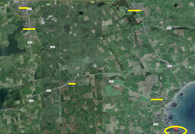
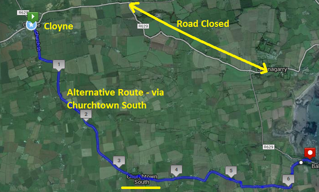
Traffic Diversion
The Cloyne / Shanagarry Rd (R629) will be closed for works between Ballymaloe More and Shanagarry from 8am Mon 24th Aug to 9pm Fri 4th September. Diversions will be in place.
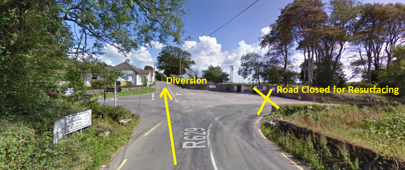
Diversion Route 1 - Recommended by Cork Co Council....Sorta..
On the main road from Cloyne to Ballycotton, at the cross-road, by the
entrance to Ballymalow House, continue straight on, as the road to the
right is closed for resurfacing.
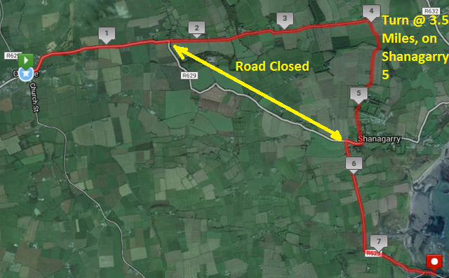
Cork Co Council recommends continuing on until the Ladysbridge-Garryvoe
road - just before the 3 mile mark in the Shanagarry 5. However
the quicker way is to turn right, downhill, at the 3.5 mile mark.
This brings you into Shanagarry, along the Shanagarry 5 course.
Alternative Route - Via Churchtown South
Event Details
Ballycotton Running Promotions website
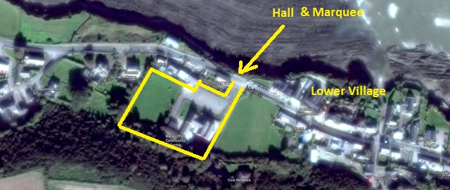
Entries will be taken in the Hall at Ballycotton National School. There
will be two separate sets of entry desk
a) For those who ran in ALL of the first three races, and
b) for those who did NOT run in ALL of the previous races in the
series.
If you ran the first three races, please check
your bib number, on the wall, or on the list on the Ballycotton
Running Promotions website, before approaching the entry desk.
Results of Ballyandreen 5 2015
Results in PDF format - Ballycotton Running Promotions website
Results on Cork Athletics website
Results of Shanagarry 5 2015
Results in PDF format - Ballycotton Running Promotions website
Results on Cork Athletics website
Results of Churchtown South 5 2015
Results in PDF format - Ballycotton Running Promotions website
Results on Cork Athletics website
Results of Last Year's Race - Ballycotton 5 2014
Course Details
Route
on MapMyRun
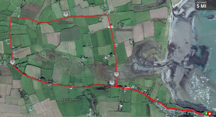
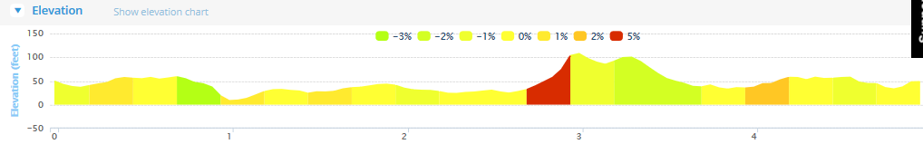
Route Elevation Profile